Georgia's warm and dry weather continued in October. Drought in southeast Georgia increased and record-high temperatures were tied or set at many locations.
Temperatures across the state were warmer than normal almost everywhere. In Atlanta, the monthly average temperature was 65 degrees F (2.5 degrees above normal), in Athens 63.4 degrees (1.6 degrees above normal), Columbus 68 degrees (2.2 degrees above normal), Macon 64.6 degrees (.7 degree above normal), Savannah 69.1 degrees (2 degrees above normal), Brunswick 70.6 degrees (1 degree above normal), Alma 68.4 degrees (.1 degree below normal), Valdosta 69.6 degrees (2.2 degrees above normal) and Augusta 64.2 degrees (1.1 degrees above normal).
Daytime temperatures continued to be warm, but, due to the dry conditions, overnight low temperatures were more moderate. High temperatures were tied or set at many locations during the last week of October due to persistent southerly flow from the Gulf of Mexico. New records included 91 degrees at Brunswick Oct. 26, smashing the old record of 85 degrees set in 1963.
Several airport locations recorded their warmest or near warmest May through October on record, including Savannah, Atlanta and Columbus.
Almost all of Georgia was below normal in rainfall. The southeastern coastline was the driest.
The only two areas with above-normal rainfall were in the counties west-southwest of Atlanta and a small region in the mountains of northeast Georgia. The heaviest rains fell during the last week of the month when a record-setting low pressure center in the Midwest brought a strong cold front through the South, dropping rain and severe weather through the region.
The highest monthly rainfall total from National Weather Service reporting stations was 3.33 inches in Atlanta (.22 inch above normal). The lowest was in Alma at .16 inch (2.63 inches below normal). Athens received 1.42 inches (2.05 inches below normal), Brunswick .41 inch (3.5 inches below normal), Valdosta .57 inch (2.45 inches below normal), Columbus 1.48 inches (.85 inch below normal), Macon .95 inch (1.42 inches below normal), Savannah .6 inch (2.52 inches below normal) and Augusta .67 inch (2.53 inches below normal).
The highest single-day rainfall from the Community Collaborative Rain, Hail and Snow Network stations was 3.65 inches at Carrollton in Carroll County Oct. 28. An observer south of Greensboro reported 3.6 inches. An observer southeast of Athens reported 3.31 inches on the same day. Another observer in Richmond Hill reported 3.35 inches Oct. 25. The highest monthly totals were 5.63 inches near Dillard in Rabun County and 5.4 inches near Peachtree City in Fayette County.
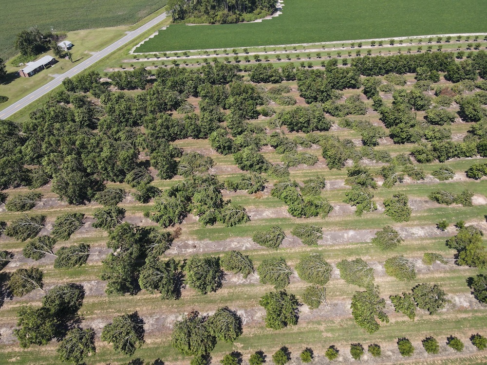
The last week of the month was a very active time for severe weather. Three tornadoes were observed. Two tornadoes were reported Oct. 24 in far northwest Georgia, one in Dade County and the other in Catoosa County. A small tornado was reported Oct. 27 in Cherokee County. The severe weather caused problems for drought-stricken trees in southwestern Georgia, making them susceptible to broken limbs and uprooting.
It is interesting to note that the last time a strong La Nina (similar to this year) occurred with no hurricane landfalls on the United States was 1973. Since 1900, this is the first time we have had a hurricane season of ten or more storms without one hitting the U.S. as a hurricane.
The dry conditions continued to affect harvests and yields of several Georgia crops. There were a few small and scattered areas of frost in some rural areas.