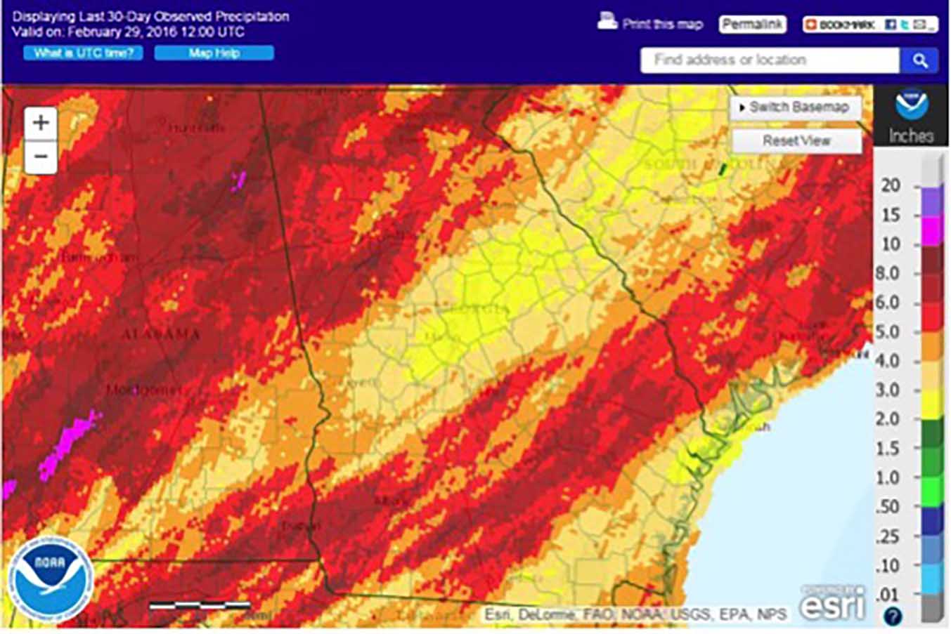
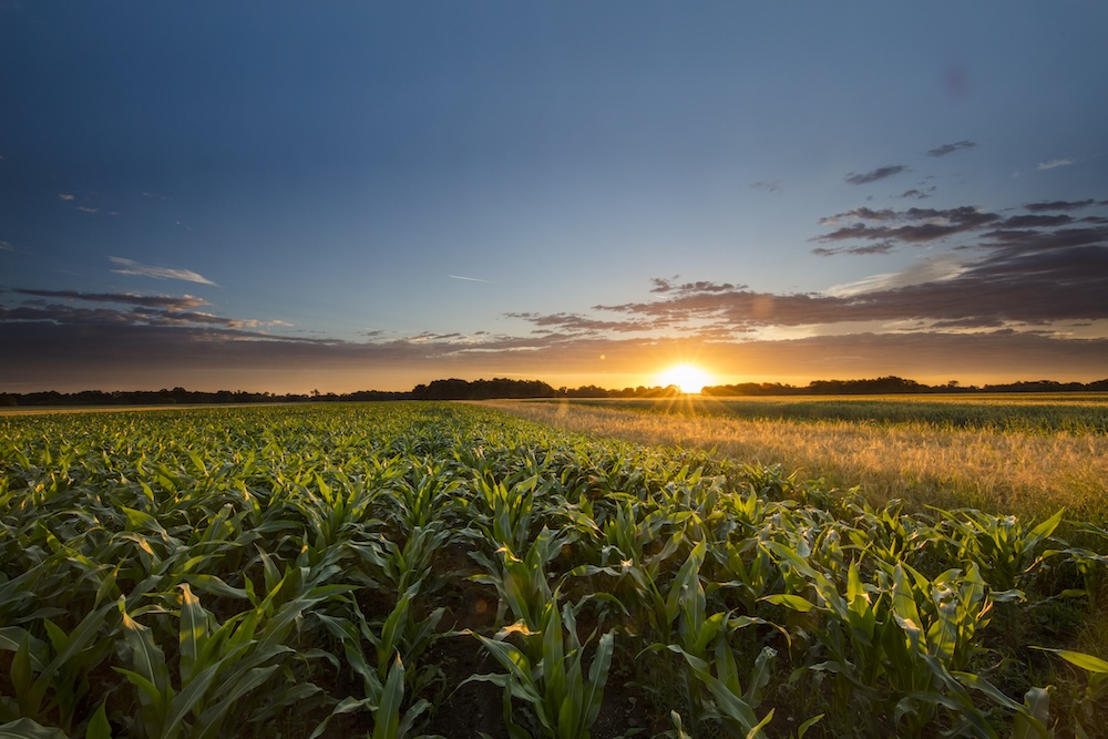
Overly wet weather in Georgia’s major row crop regions during February 2016 has farmers worried that soggy soil may delay corn and peanut planting or cause fungal diseases to be a major issue later this spring.
Over the course of February, swaths of northwest and southeast Georgia received as much as three or four inches more rainfall than normal, leaving some farm fields that have reached the planting milestone of 55 degrees Fahrenheit too wet to plant.
Other parts of the state, especially the central region, saw rainfall totals between two and three inches below normal amounts.
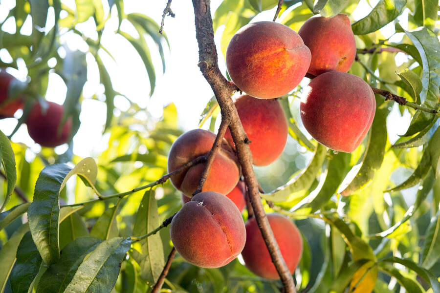
Fruit growers continue to be concerned about the low number of chill hours that have occurred this winter, due mainly to the extremely warm temperatures in December 2015. Low chill hours reduce fruit set and lengthen the harvest season, leading to increased labor costs needed to harvest the orchards more than once.
Temperatures during February varied across the state but were slightly above normal over the bulk of the state.
In Atlanta, Georgia, the monthly average temperature was 48.5 F, 1.3 degrees above normal; in Athens, Georgia, it was 47.6 F, 0.4 degrees above normal; in Columbus, Georgia, it was 51.3 F, 0.2 degrees above normal; in Macon, Georgia, it was 50.6 F, 0.6 degrees above normal; in Savannah, Georgia, it was 53.7 F, 0.7 degrees above normal; in Brunswick, Georgia, it was 54.3 F, 0.2 degrees below normal; in Alma, Georgia, it was 53.5 F, 0.7 degrees below normal; in Augusta, Georgia, it was 49.8 F, 0.7 degrees above normal; in Albany, Georgia, it was 53.1 F, 0.7 degrees above normal; in Rome, Georgia, it was 46.1 F, 0 degrees below normal; and in Valdosta, Georgia, it was 54.8 F, 0.6 degrees above normal.
Atlanta set a record high of 76 F on Feb. 2, beating the old record of 74 F set in 2014. Savannah and Augusta tied their record highs on the same date. Alma set a record high of 68 F on Feb. 3, surpassing the old record of 66 F set in 1974. Augusta also set a record for high nighttime low on Feb. 3, reaching a low of only 62 F and beating the old record of 60 F set in 1932. The normal low there is 34 F.
Most of Georgia was above normal as far as precipitation in February, except for a streak of dry conditions across the center of the state from Columbus through Macon to Augusta.
The highest monthly total precipitation recorded by a National Weather Service station was 7.39 inches in Atlanta, 2.72 inches above normal. The lowest monthly total was recorded in Macon at 3.21 inches, 1.15 inches below normal. Athens received 4.49 inches, 0.01 inches above normal; Columbus received 4.23 inches, 0.21 inches below normal; Augusta received 3.76 inches, 0.16 inches below normal; Savannah received 3.28 inches, 0.49 inches above normal; Alma received 4.66 inches, 0.86 inches above normal; Brunswick received 3.99 inches, 0.52 inches above normal; Rome received 5.64 inches, 0.77 inches above normal; Valdosta received 4.97 inches, 0.81 inches above normal; and Albany received 6.65 inches, 2.49 inches above normal.
Atlanta, Athens, Macon and Rome all reported a trace of snowfall on Feb. 9 and 10.
The highest single-day rainfall recorded by a Community Collaborative Rain, Hail and Snow Network volunteer was 5.42 inches west of Albany in Dougherty County on Feb. 24, followed by 4.75 inches recorded north of Cochran, Georgia, in Fulton County on Feb. 4. The highest monthly total rainfall was 9.34 inches, recorded by the Albany observer listed above, followed by 9.02 inches near Dillard, Georgia, in Rabun County in northeast Georgia. The Dillard observer also recorded the highest snowfall for the month – a total of 5.2 inches.
Severe weather was reported on four days during February.
Observers witnessed a tornado at Fort Stewart, Georgia, near Hinesville in Liberty County on Feb. 3. Numerous vehicles were destroyed, and 40 to 50 people were displaced from housing due to the tornado.
Another storm outbreak brought high winds to much of Georgia on Feb. 15. No tornadoes were observed in the state, but several were seen nearby in southeast Alabama.
Witnesses reported seeing several tornadoes on Feb. 23, including one near Blakely, Georgia, in Early County, an EF1 in Terrell County, plus other sightings in Lee County and in Whigham, Georgia, in Grady County. The tail end of that outbreak hit the far northeast corner of Georgia on Feb. 24 as the system moved to the east.
Lightning associated with the severe storms early in the morning of Feb. 24 caused a barn fire in Bishop, Georgia, in Oconee County. Fourteen Clydesdale horses were safely removed from the barn before it burned to the ground.
The outlook for March and spring shows a continuation of El Nino-like rainfall conditions, especially in south Georgia. The first two weeks of March are expected to be warmer than normal, with a return to average conditions later in the month. Longer-term spring temperatures do not show a clear trend.
El Nino appears to have passed its peak and will be dying away over the next few months. After El Nino disappears, a swing to neutral, then to La Nina is expected by late summer, which will increase the chance of dry conditions later in the growing season. The Atlantic hurricane season is also expected to be more active than usual in the absence of El Nino.
For more information, please see the Climate and Agriculture in the South East blog at blog.extension.uga.edu/climate or visit our new webpage at gaclimate.org.